Download map Download The Wild Drovers' Way leaflet (pdf)
Cenarth
Straddling the border with Ceredigion, Cenarth is the site of picturesque namesake falls on the River Teifi. Overlooking the cascades, the National Coracle Centre celebrates the traditional rounded vessel made from animal skin or waterproofed canvas stretched over a woven willow frame, long used in these parts to fish for sewin (sea trout).
Stroll up into the village to find the Ale House, an ancient whitewashed, thatched stone cottage alongside the Three Horseshoes pub, opposite the smithy. Nearby, an ancient, leathery coracle hangs outside the White Hart, another whitewashed old stone tavern dating from the 16th century.


Newcastle Emlyn
Driving east on the A484, dip down to the valley floor to follow the meanders of the Teifi through a tunnel of trees and roll down your windows to drink in the gurgles and chatter of the river en route to Newcastle Emlyn.
The town was long defined by its castle, perched on an outcrop embraced by a bend in the Teifi; today only tumbledown remains survive, dominated by the 14th-century gatehouse. Legends tell that the Wyvern, reputedly the last dragon in Wales, killed here – and a wooden dragon sculpture now peers imperiously down over wooded slopes into the valley.
The large livestock market speaks of the trade that brought the town its wealth for centuries, a major stop on the drovers’ routes from west Carmarthenshire and Pembrokeshire to Llandovery. Once the inns serving drovers and others involved in the trade would have been countless, and numerous pubs still line the streets, not least the venerable Emlyn Hotel, which now incorporates the Petit Biarritz Basque deli. Look out for nearby Cawdor Hall, the clocktower-topped market building, which houses the Hanes Emlyn local history centre and The Attic theatre.


Henllan and Dre-fach Felindre detours
Continuing east along the southern bank of the Teifi, short detours from the road lead half a mile north to Henllan to the narrow-gauge heritage Teifi Valley Railway, and the same distance south to the National Wool Museum at Dre-fach Felindre. Beyond Henllan, take the B4335 to stick close to the river before eventually the route climbs out of the valley, revealing sweeping views east across to wilder hills, rust-tinged orange with bracken.
East of Llanfihangel-ar-arth, the road veers north through the implausibly long village of Llanllwni – flanked to the east by the looming flanks of Mynydd Llanllwni, glimpsed from the road through gaps in hedges and houses – to Llanybydder. Two centuries ago the streets would once have rung with the clatter of shod cattle and the cries of drovers; today it’s another peaceful rural Carmarthenshire village, its inns largely gone.
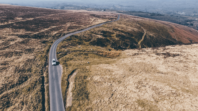
From Cwmann, just south of Lampeter, turn southeast onto the A482 then swiftly fork left at the former Ram Inn, a whitewashed 16th-century edifice, onto meandering, steeply undulating lanes. Lined with high, hedgy banks adorned with ferns and moss, hemmed in by rounded hills, you’re plunging into the thick of drover country. Take it slow, not just because the lanes are winding and narrow, but also because the views east towards the southern foothills of the Cambrian Mountains are spectacular.


Ffarmers
Pause in Ffarmers, named for the now-closed Farmers’ Arms. Today this little hamlet is blessed with the Drovers’ Arms, a community-run pub that would long have been a favourite watering hole for those tough travelling men. Word has it that the grander house opposite – formerly the village shop – was also a pub in times gone; the wealthy stock owners would drink in one inn while the lowlier drovers congregated in the simpler tavern across the road.
South of Ffarmers, and continuing to rejoin the A482, the road is curiously straight – betraying its origins as a Roman road, built to link forts at Moridunum (Carmarthen) and elsewhere in Wales with the nearby gold mines. Unsurprisingly, drovers also followed this handy route, though by the 19th century they were forced to pay for the privilege – the tollhouse, now a private dwelling, still stands on the road north of Pumsaint.


Pumsaint and Dolaucothi
In that hamlet itself, opposite the Dolaucothi Arms, is the old forge, established in 1756. Long before it became an important drovers’ stop, Pumsaint’s fortunes were tied to the Dolaucothi Gold Mines. Worked since Roman times, Pumsaint is built over the site of the Roman fort of Luentinum. Today you can explore the mines, off the main A482 and now managed by the National Trust, on a guided tour.


Caio
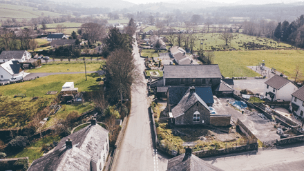
Past Dolaucothi, continue along steep, narrow roads to Caio, once another important spot for dealing livestock, now a hamlet of colourful houses hidden in a side valley with an impressive old church.


Rhandir-mwyn detour
The road beyond rises and dips through round-shouldered hills, with red kites flapping and hovering above, to reach the Tywi Valley north of Llandovery. Here, across the narrow stone Dolauhirion Bridge on the outskirts, another worthy detour beckons: turn left to follow the Tywi upstream to Rhandir-mwyn, guarded by forested hills to either side, to discover some of the most gloriously verdant scenery in west Wales.


Llandovery
Otherwise, turn right to reach Llandovery – the beating heart of drover country. Even today, weekly livestock sales are big business, and the centre retains numerous reminders of its drover heritage. The 13th-century castle is now just a fractured stump on a grassy knoll, guarded by a sculpture representing Welsh resistance hero Llywelyn ap Gruffydd Fychan.
Nearby, opposite the Castle Hotel and outside the Llandovery museum, stands an earthier stature: a plump, glowering drover with hearty whiskered chops, a long coat, hat and stick – every inch the tough, independent country man. At the Kings Head, opposite the old market, the Banc yr Eidion Du (Bank of the Black Ox) was founded in 1799, providing services for drovers; open the door to see its ancient timber frame. Today the town is studded with appealing places to stay, eat and drink – try the Bear Inn for vegetarian treats, the Castle Hotel for fine pub fare or La Patisserie for excellent cakes.


Graze

Places to eat & drink along the way
> Riverside Café, Newcastle Emlyn
> Royal Oak, Rhandirmwyn
> The Bear, Llandovery
> Myddfai Community Centre
Rest

Places to stay along the way
> Emlyn Arms Hotel, Newcastle Emlyn
> Brynglas Cottage, Rhandirmwyn
> Drovers B&B, Llandovery
Recharge

We are adding more charges to our network. We encourage you to use our Zap Map below to:
> find a charge near you
> view available charges